

If you searched “permit fly fishing Chetumal” to get here, you’re already ahead of most anglers. Chetumal is the name that shows up on a map — it’s the bay, the border city, the body of water shared between Mexico and Belize. Xcalak is the village at the end of the road where you actually get on a boat. Most of what’s written about this fishery talks about Xcalak. Almost nothing talks about Chetumal Bay itself: what kind of water it is, why it holds permit the way it does, and why it doesn’t fish like anywhere else on the Yucatan coast.
That’s worth fixing, because the bay is the whole story. Xcalak is just the door you walk through to get to it.
Xcalak Is the Village. Chetumal Bay Is the Fishery.
Xcalak sits on a narrow strip of land where Chetumal Bay meets the Caribbean Sea, at the southern tip of Quintana Roo, a few miles north of the Belize border. The village gives you a place to sleep, eat, and launch a boat. The fishery — the permit, the bonefish, the tarpon, the water itself — belongs to the bay.
That distinction matters more than it sounds like it should. Anglers researching “Xcalak” find village logistics: how to get there, what to pack, where to stay. Anglers researching “Chetumal Bay” are usually asking a different question: what makes this specific body of water worth flying to Mexico for. This piece is for that second group. For trip logistics, our Xcalak trip guide covers all of it. Here, we’re staying on the water.
An Estuary, Not a Reef Flat
Most of the Yucatan’s famous permit water — Ascension Bay, Espiritu Santo, the reef flats around Belize — is essentially marine. Clean ocean salinity, hard sand and turtle grass, water pushed by tide and wind off the open Caribbean.
Chetumal Bay isn’t built that way. The Río Hondo, which forms the border between Mexico and Belize, empties directly into the north end of the bay, and that freshwater mixes with incoming seawater from the reef side to create a genuine estuary — brackish through most of its range, closer to fresh the farther north and west you go. Biologists classify it as mesohaline water, which is a technical way of saying it’s neither river nor ocean. It’s both, blended, and the mix isn’t uniform: salinity shifts by season, by rainfall, by how close you are to the river mouth versus the reef.
The bay is also just enormous — bigger than Ascension Bay and Espiritu Santo Bay combined, by most estimates over 1,100 square kilometers of water. And it’s protected water. Chetumal Bay was designated a manatee sanctuary in 1996, which tells you something useful even if you’re not there to see manatees: this is a shallow, seagrass-and-mangrove-rich system healthy enough to support one of the most sensitive marine mammals in the hemisphere. That kind of habitat doesn’t happen on a hard-sand ocean flat. It happens in an estuary.
None of this is trivia. It’s the reason the fish behave the way they do.
What a Brackish Bay Does to a Permit
Permit on a reef-adjacent flat are working a fairly narrow menu: crabs and shrimp holding in turtle grass and clean sand, in water that’s essentially full-strength seawater year-round. Permit in Chetumal Bay are working an estuary — a nursery system with a much wider range of bottom type (soft mud in the lagoons, mixed sand and grass on the mid-bay flats, harder sand near the reef-side cuts) and a forage base shaped by that gradient. Guides who’ve fished the bay their whole lives will tell you the same school of permit can sit in noticeably different water — cloudier, softer-bottomed, more sheltered — than what you’d expect to find permit holding in on a classic ocean flat.
The practical result is a fishery with a longer runway. Because so much of the bay stays sheltered and productive rather than depending entirely on open-ocean conditions, permit here aren’t pinned to as tight a seasonal window as fish that stage and move with more purely oceanic patterns. We see peak activity March through June, same as most Yucatan permit water, but the bay holds fishable numbers of permit close to year-round — a big part of why when you fish Xcalak matters less here than at other destinations built around a narrower season.
The habitat diversity inside the bay is worth understanding on its own terms too — we’ve broken down the lagoons, flats, and mangrove channels in detail in our full Xcalak fishing guide. What’s worth adding here is why that diversity exists at all: it’s downstream of the bay being an estuary instead of a reef flat. A reef-adjacent fishery doesn’t give you a soft-bottomed backwater lagoon a twenty-minute boat ride from a hard sand flat with clean visibility. Chetumal Bay does, because it’s one watershed with a river on one end and a barrier reef on the other.
Chetumal Bay vs. Ascension Bay: Two Different Fisheries, Not Two Versions of the Same One
Ascension Bay gets more attention, and deservedly — it holds one of the largest concentrated permit populations anywhere, with extensive hard-sand flats built for wading and sight-fishing to big, visible schools. It’s also more established: more lodges, more boats, more anglers casting to the same fish week after week.
Chetumal Bay runs a different program. The bay itself is larger, but the number of guides working it stays small — this remains a place where local knowledge, not boat traffic, decides whether you find fish. The water is more varied by nature (estuarine lagoons alongside open flats alongside reef-adjacent sand), which means a guide who knows the bay can usually find a fishable piece of it regardless of wind or tide. And because pressure stays low, permit here tend to give you more patient shots — fish that don’t necessarily bolt at the first sloppy cast the way heavily-pressured fish do elsewhere.
Neither fishery is objectively better. Ascension Bay will usually put more permit in front of you in a single day. Chetumal Bay gives you a quieter, more varied fishery where the fish haven’t seen twenty anglers already that week. If you’ve fished the well-known water and want to see what an unpressured, river-fed permit fishery looks like, this is that trip.
Why Xcalak Is Still the Right Way to Fish It
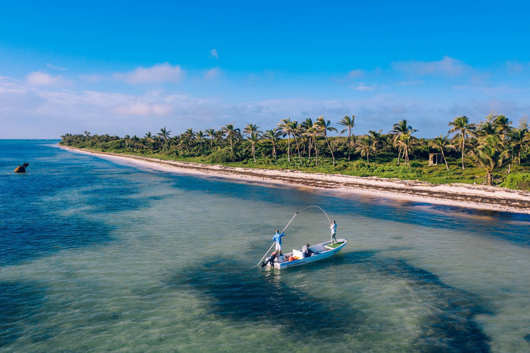
Here’s where the village earns its place in the story. Xcalak sits at the exact point where Chetumal Bay’s estuarine water meets the Mesoamerican Reef through a network of mangrove-lined cuts. Guides working out of Xcalak can run north into the bay’s lagoons and soft-bottom flats in the morning and be poling a hard sand, reef-adjacent flat by afternoon — access to both ends of the estuary-to-reef gradient in a single day. That range is exactly why the habitat diversity we’ve described above translates into a fishable week instead of a theoretical one.
Our guides grew up on this water, not on a generic stretch of Yucatan coastline — they know which lagoons hold resident schools when the bay flats get pushed by wind, and which mud lines mean permit are working a falling tide. That’s the kind of knowledge that only comes from fishing one specific, unusual body of water for a lifetime, and it’s the difference between hearing about Chetumal Bay’s reputation and actually finding fish in it.
Chetumal Bay Permit Fishing: FAQ
Is Chetumal Bay good for permit fishing? Yes. Chetumal Bay is a large, river-fed estuary on the Mexico–Belize border that holds permit close to year-round, with peak activity March through June. Its brackish, mixed-habitat water (mangrove lagoons, open flats, reef-adjacent sand) supports a resident permit population that sees far less fishing pressure than better-known Yucatan destinations.
What’s the difference between Chetumal Bay and Xcalak? Xcalak is the fishing village where anglers stay and launch boats. Chetumal Bay is the actual body of water — a brackish estuary fed by the Río Hondo — where the fishing happens. Guides based in Xcalak fish the Mexican portion of Chetumal Bay along with the reef-adjacent flats just outside it.
How does Chetumal Bay compare to Ascension Bay for permit? Ascension Bay holds a larger, more concentrated permit population on extensive hard-sand flats, and sees significantly more fishing pressure. Chetumal Bay is a larger body of water overall, fished by a small number of guides, with more varied habitat (estuarine lagoons, mixed-bottom flats, reef-adjacent sand) and less-pressured fish.
When’s the best time for permit fly fishing in Chetumal Bay? March through June is peak, with May in the heart of it. Because the bay stays productive across a wider range of conditions than purely oceanic fisheries, permit are catchable in every season — see our seasonal breakdown for month-by-month detail.